


Exploring The Barlow Road By Wheelchair
By Guest Author: Lilly Longshore
Article At A Glance
- Follow the historic Barlow Road, which was a key part of the Oregon Trail journey through Clackamas County, from Barlow Summit and Laurel Hill Chute to Oregon City, the trail's historic endpoint.
- Learn which Barlow Road landmarks, viewpoints, museums and interpretive sites can be experienced from a wheelchair or mobility device.
- Visit wagon routes, pioneer graves, tollgate replicas and scenic overlooks that reveal the challenges faced by emigrants traveling to Oregon in the 1840s.
Intrigued by pioneers’ powerful stories of survival along the Oregon Trail, I wanted to know more. Because the Barlow Road ran right through Clackamas County, that was my focus. Constructed in 1846, it provided a land route to Oregon City, eliminating the treacherous float down the Columbia River. How much of it is still visible? How much can I see from my powerchair? I was on a mission to find out.
Beginning at the Mt. Hood Cultural Center and Museum in Government Camp, I learned this museum is on a segment of the old Barlow Road, now called Government Camp Loop. Museum manager, Cheryl, gave me a tour of the wheelchair-friendly museum and great suggestions for my Barlow Road exploration. The exhibits of the maple carving from the original Barlow Tollgate and a section of covered wagon cloth which had been painted to serve as “carpet” were stand-out exhibits for me.

This is a section of covered wagon cloth which had been painted to serve as carpet.
Using a map plus GPS, I headed east to Barlow Summit to begin my accessible trek. I largely followed US 26 with some turnoffs. Pulling off US 26 at Barlow Pass Snow-park/trailhead, I saw where the historic road cut through the summit from the parking lot. I then drove west to FR 3531 to Pioneer Woman’s Grave. I left my van and rolled down the road where I could see the memorial. This is one of many graves, some marked and some not, along the 2000-mile Oregon Trail.
Two miles west, I visited Summit Meadow on FR 3530, which is a rough gravel road. Here, pioneers camped and rested before attempting the dangerous descent at Laurel Hill Chute. My view from Summit Meadow of snow-covered Mt. Hood was dazzling. The meadow and the small pioneer graveyard were easily visible from the road.

The replica tollgate is an accessible location along the historic Barlow Road.
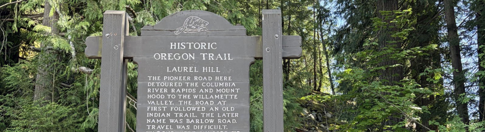
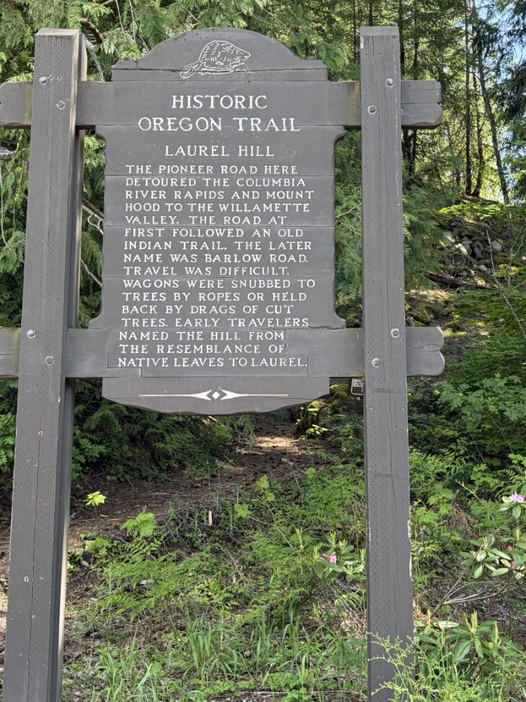
Near milepost 50, Laurel Hill Chute is a pull-off along US 26 marked with a sign. Imagining lowering wagons by rope down this cliff gave me chills.
Continuing west to Pioneer Bridle Trailhead, I found the historic Tollgate replica in a shady and verdant spot east of the gravel parking lot. I wheeled right through the tollgate. I knew that each wagon was charged $5 to pass, but I didn’t know that each person and every animal were additional charges.
In Welches, I came to Wildwood Recreation Site, a great stop for accessible hikes, restrooms and picnics. East of the entrance, a historic marker relays harrowing journal excerpts from worn pioneers. Remnants of the Barlow Road run behind the historic marker. Here's a great blog about the accessibility at Wildwood Recreation Site.

Jonsrud Viewpoint offers an incredible view of Mt. Hood.
Jonsrud Viewpoint in Sandy is a nicely accessible roadside vista. It gives a good view of what the pioneers faced coming across the “Devil’s Backbone.” Philip Foster Farm in nearby Eagle Creek was a significant rest stop for emigrants on the final stretch of their journey.
In Oregon City, I had previously visited The End Of The Oregon Trail Interpretive & Visitor Center, which offers many must-see exhibits and is nicely accessible.
This concluded my wheelchair tour of the Barlow Road, and I was satisfied with all that I could see from my wheelchair along this captivating historic route.

Lilly Longshore is an accessible travel writer, a speaker and an advocate/educator for those with physical disabilities and vision impairments. She has written for various magazines including New Mobility, PN Magazine and Cascade Journal, as well as for various travel blog sites. Passionate about traveling and sharing possibilities with others, she adventures via wheelchair and shares the world of travel possibilities through her writing. After retiring from civil/environmental engineering, she continued to give back to her community by serving as parent representative on the Board for the Washington State School for the Blind, on Washington’s Governor’s Committee on Disability Issues and Employment and is currently serving as Community Outreach Chair for Clark County, Washington’s Accessible Communities Advisory Committee. Connect with Lilly through her Wheeling the World Facebook page. Photo by Carla Foth Christian.


